
The India Meteorological Department (IMD) has issued a warning for heavy to very heavy rainfall across 15 states in India, expected to persist over the next 6 to 7 days, starting from May 23, 2025. This widespread weather event will impact regions in North, East, Northeast, West, and South India, driven by a low-pressure area in the east-central Arabian Sea off the coasts of North Karnataka-Goa. This system is anticipated to intensify into a deep depression and potentially develop into a cyclonic storm, bringing strong winds, thunderstorms, and significant rainfall.
Affected Regions
The IMD’s forecast highlights the following states and regions:
- Western Coast: Gujarat, Konkan & Goa, Karnataka, and Kerala are set to experience heavy to very heavy rainfall, with isolated areas in Konkan & Goa expecting extremely heavy rainfall (over 20 cm) from May 22 to 24, and Coastal Karnataka on May 24.
- Northeast India: Assam, Meghalaya, Arunachal Pradesh, and neighboring states are likely to see heavy rainfall, especially in the next 3 days.
- South India: Tamil Nadu, Andhra Pradesh, and parts of Karnataka are under alert, with some areas facing isolated extremely heavy falls.
- Central and Eastern India: Madhya Maharashtra, Marathwada, and parts of West Bengal are also expected to encounter heavy rainfall accompanied by thunderstorms.
Weather System Details
The primary cause of this weather event is a low-pressure area forming over the east-central Arabian Sea, which is projected to strengthen into a deep depression and move northward. The IMD is monitoring the possibility of this system evolving into a cyclonic storm, which could heighten the severity of the weather. Additionally, there’s an indication of an early monsoon arrival, which may amplify rainfall and contribute to more extreme conditions.
Potential Impacts
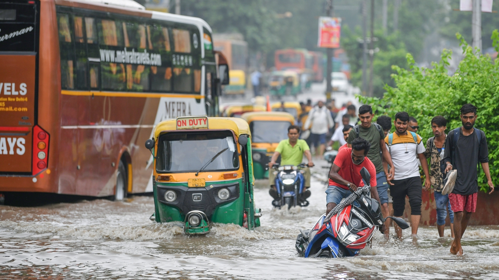
This weather system poses several risks, including:
- Flooding and Landslides: Areas like Kerala, coastal Karnataka, and Goa are particularly vulnerable to localized flooding and landslides due to the intensity of the rainfall.
- Disruptions: Expect waterlogging, traffic issues, and potential infrastructure damage in urban and rural areas alike.
- Cyclonic Threat: If the system develops into a cyclone, coastal regions, especially Maharashtra and Goa, could face heightened risks, prompting red alerts in these areas.
Timeline
The heavy rainfall is forecasted to span 6 to 7 days, with specific peaks:
- May 22-24: Extremely heavy rainfall over Konkan & Goa.
- May 24: Extremely heavy rainfall over Coastal Karnataka.
- May 23-25: Red alert conditions in Goa, with persistent heavy rain.
The northward movement of the low-pressure system will influence different regions progressively over this period.
Current Situation
Many states are already grappling with heavy rainfall and thunderstorms. For instance:
- Mumbai and Goa: Red and orange alerts are in place due to intense rainfall and cyclonic potential.
- Northeast India: Assam and adjacent areas are preparing for significant rainfall.
- South India: Unseasonal rains in Karnataka and Tamil Nadu have caused waterlogging and disruptions.
Recommendations
Residents in the affected regions should:
- Stay updated with IMD advisories and local weather reports.
- Prepare for possible flooding, landslides, and service interruptions.
- Limit travel and remain indoors during severe weather.
- Keep emergency supplies handy for potential outages or emergencies.
This weather event is a major concern due to its scale, the potential for cyclonic development, and the early monsoon influence. Vigilance and preparedness are essential to mitigate its impacts across the 15 affected states.